One of the main thoroughfares of Brisbane’s Central Business District. Established before Brisbane had a business district.
1842 – Adelaide Street is named.
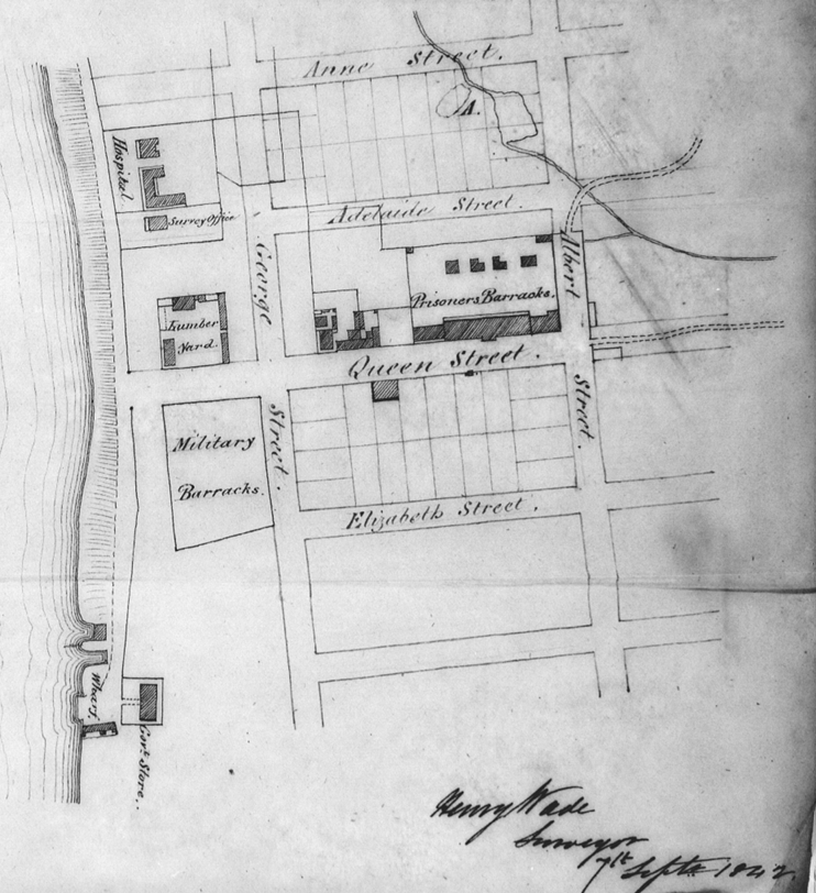
Moreton Bay had been proclaimed as a place of free settlement, and Lieutenant Owen Gorman and his Regiment had been recalled, handing over management to Dr Stephen Simpson until Captain Wickham could take up his post as Government Resident. The Government Surveyor’s office at Brisbane had lost Granville Stapylton to an attack by indigenous people, and Robert Dixon to a heated dispute with the former commandant.
Surveyor Henry Wade was brought up to Brisbane, tasked with making a survey, and keeping a record of the lots being allocated and sold around town. Wade spent most of 1842 trying to impose some order on this rather haphazard process. Mr Wade fell foul of his superiors by pointing out numerous errors in their previous efforts, including the presence of brickworks that would affect drainage and turn Ann Street into a lakeside resort after heavy rains. No-one likes a complainer, and in the course of fulfilling his duties, Mr Wade fell out first with Dr Simpson, then with his all of his fellow surveyors. He chose to return to Sydney in 1846.
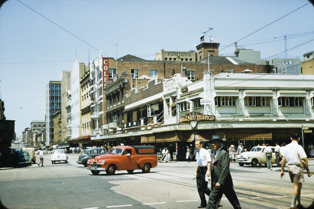
Adelaide Street over the years
Adelaide Street today.
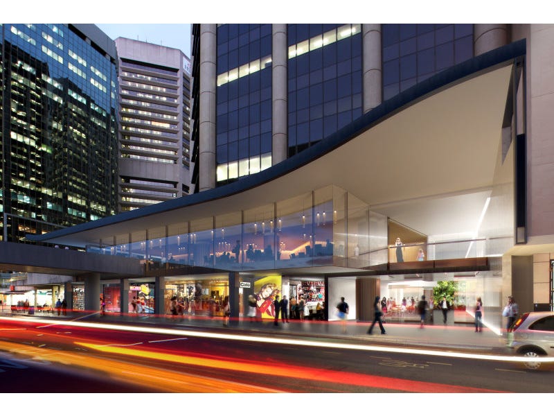
Today, Adelaide Street Brisbane runs from North Quay by the Brisbane River and terminates at Boundary Street near Fortitude Valley. Along the way, it boasts some important places – City Hall, the Brisbane Square Library, the Consulates of China and the Republic of Korea, the South African War Memorial, and the Department of Home Affairs. You can also get eyelash extensions, hire a lawyer and eat a lifetime’s supply of sushi. Not all at the same time though, unless the proprietors of those establishments are extremely accommodating.
For those seeking a place to relax outdoors, Adelaide Street has King George Square (it’s that wilderness of paving stones and bollards in front of City Hall), as well as Anzac Square and Post Office Square (which do have shady spots and grassed areas). Several laneways run off Adelaide Street, including Ely Lane, Faber Lane, Gresham Lane and Isles Lane.
- People and vehicles at the intersection of Albert and Adelaide Streets, Brisbane, 1957. Original version photographic print : colour, January 1957. State Library of Queensland, from the collection of the Love/Lovf family. State Library of Queensland.
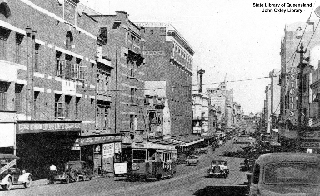
- View along Adelaide Street, Brisbane ca. 1940. Author / Creator Sydney G. Hughes. Original version copy print : black & white, ca. 1940, Negative number: 109967. State Library of Queensland.
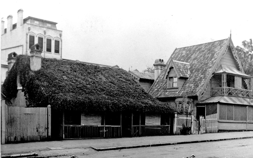
- Houses in Adelaide Street, Brisbane, 1912. Author / Creator Colclough, E. Original version photographic print : black & white, 14 September 1912, Negative number: 39012. State Library of Queensland.
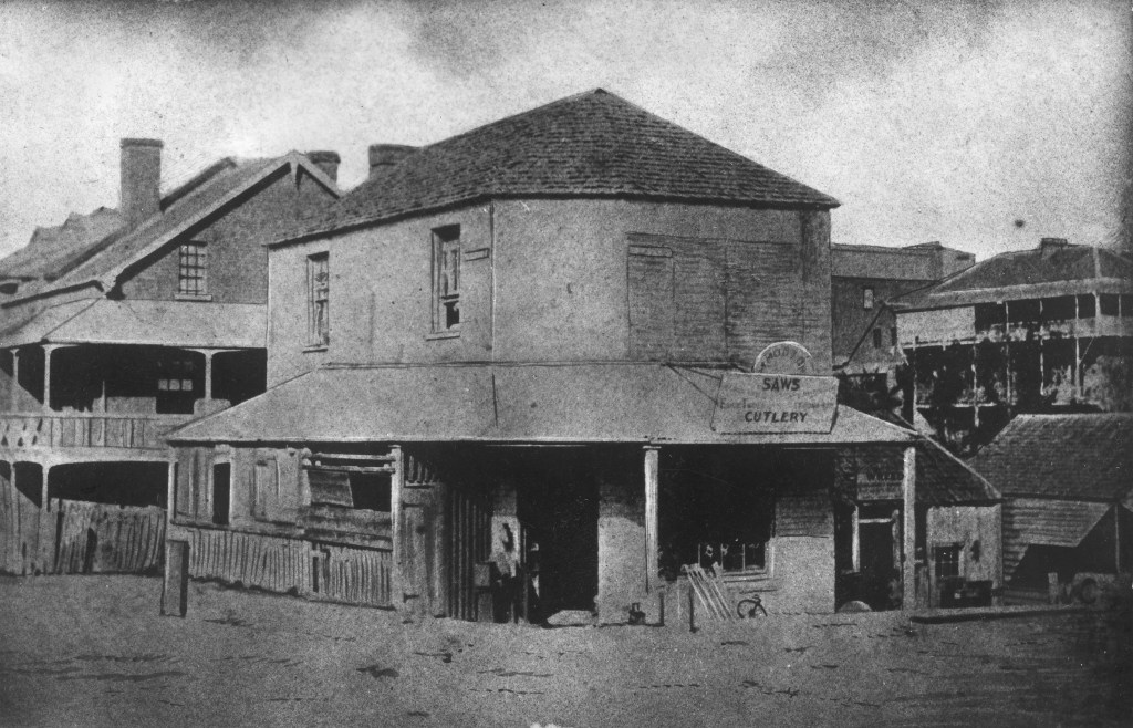
- Building at the north-east corner of Edward and Adelaide Streets, Brisbane, ca. 1870. Original version photographic print : black & white, ca. 1870, Negative number: 202362. State Library of Queensland.
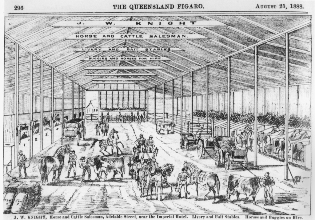
- Advertisement for J. W. Knight’s Livery Stables, 1888. Original version copy print : black & white, August 1888, Negative number: 63366. State Library of Queensland.
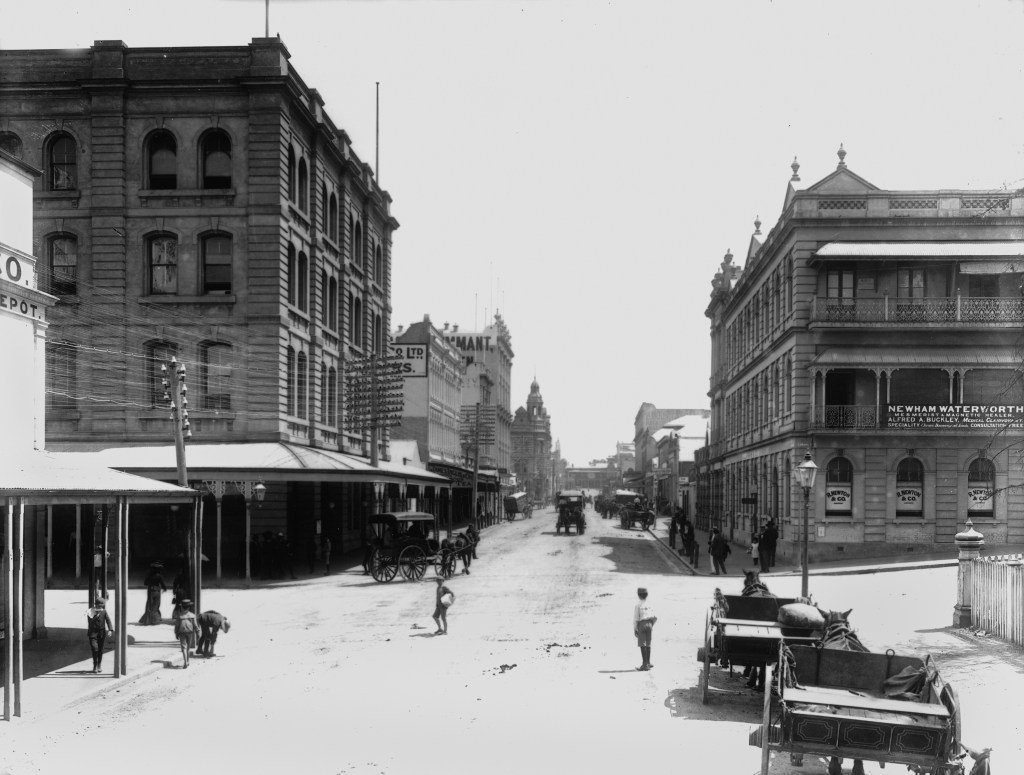
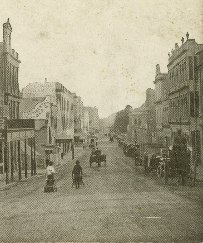
- Adelaide Street looking towards George Street, Brisbane, 1900? Author / Creator Poulsen, P. C. (Poul C.), 1857-1925. Original version copy print : black & white, 1900? Negative number: 123306. State Library of Queensland.
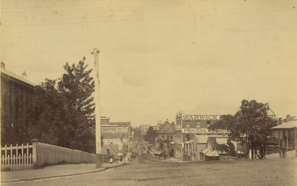
- Adelaide Street near Edward Street, ca. 1887. Original version photographic print : black & white, ca. 1887, Negative number: 18883. State Library of Queensland.
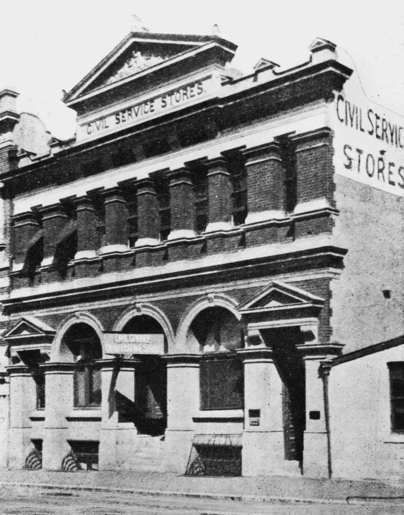
- Civil Service Stores, Adelaide Street, Brisbane, 1906. Original version photographic print : black & white, 1906, Negative number: 10710. State Library of Queensland.
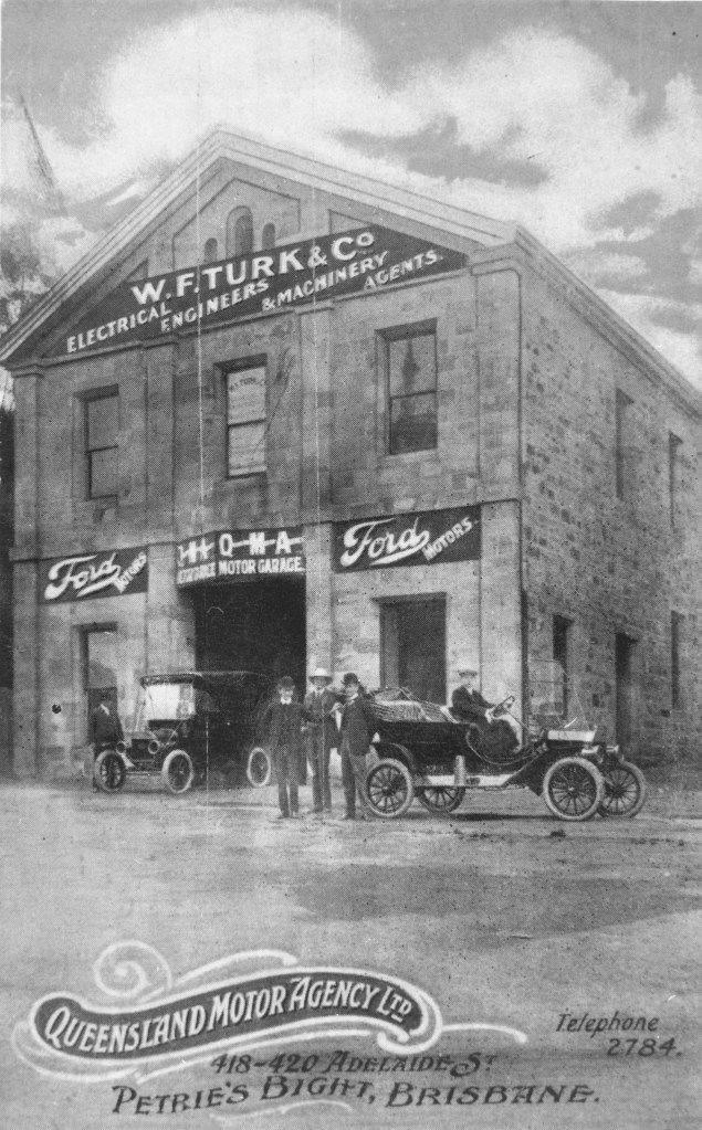
- Queensland Motor Agency building in Adelaide Street, Brisbane, ca. 1909. Original version photographic print : black & white, ca. 1909, Negative number: 109412. State Library of Queensland.
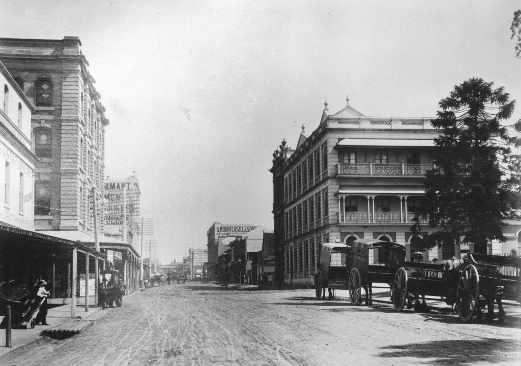
- Looking south along Adelaide Street, Brisbane, 1890. Original version photographic print : sepia, 1890? State Library of Queensland.
- View looking along Adelaide Street in Brisbane, Queensland, ca. 1910. Original version stereographic print : black & white, 1910? State Library of Queensland.
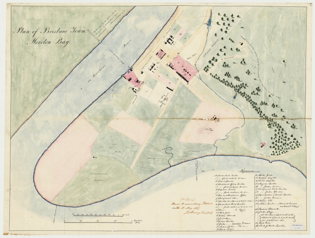
- Plan of Brisbane town, Moreton Bay 1839. Author / Creator: Barney, George, 1792-1862. Description: 1 map 57 x 78 cm and smaller. Date: 1839. Publisher Brisbane :: Geo. Barney Major. State Library of Queensland.
- 33054, Colonial Secretary’s papers 1822-1877, John Oxley Library, State Library of Queensland.
