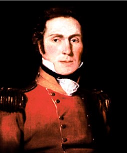
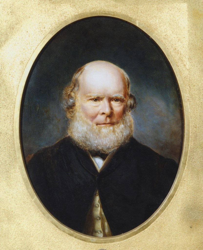
Lamington, Baron
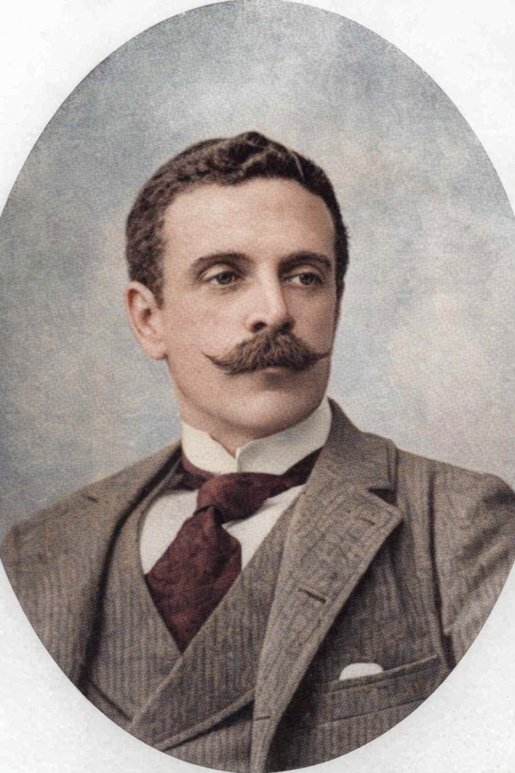
The last Governor of the colony of Queensland, and decidedly the most photogenic Governor we’ve ever had, was Lord Lamington. Or, to be more accurate, Charles Wallace Alexander Napier Cochrane-Baillie, 2nd Baron Lamington, GCMB, GCIE, FRSGS (29 July 1860 – 16 September 1940).

Despite the long-argued connection, or possible lack thereof, between His Excellency and the cake-based snack, my favourite Lamington story is his brave rescue of a dentist’s wife from a couple of hooligans. Whilst cycling.
A STRANGE INCIDENT. A story leaked out today of a gallant rescue by Lord Lamington (the Governor) of a lady who had been assailed by two ruffians. His Excellency last Saturday returned from Wellington Point show to Brisbane (a distance of about fourteen miles) on his bicycle. On the old Cleveland Road, he saw a European and a Chinaman on horseback trying to gallop down a lady, also on horseback. The Governor rode in between, despite the insults of the two, and escorted the lady safely into town. The lady is the wife of a well-known dentist.
The Queensland Times, Ipswich Herald and General Advertiser, 24 July 1897.
Lang, Dr John Dunmore
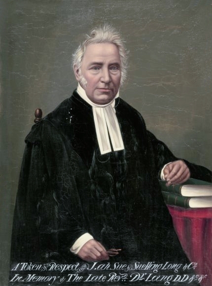
Perhaps the keenest description of Rev Dr John Dunmore Lang is contained in the Australian Dictionary of Biography:
“Presbyterian clergyman, politician, educationist, immigration organizer, historian, anthropologist, journalist, gaol-bird, and in his wife’s words engraved on his statue in Sydney, ‘Patriot and Statesman.'”
Lang’s greatest influence on Brisbane was his promotion of Protestant (and non-convict) immigration to Moreton Bay. The Fortitude, Chasely and Lima were despatched full of useful English artisans, some of whom had been assured grants of Crown Lands on arrival. That promise was not fulfilled, but the emigrants rallied and contributed greatly to the growing colony. Queensland was so grateful for them that Lang Park, Lang Parade, Fortitude Valley, and Chasely Street are constant reminders of the turbulent priest.
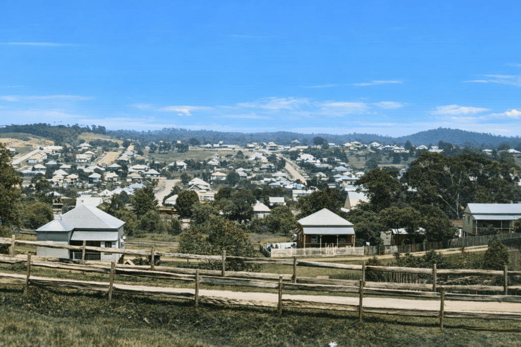
Lawnton
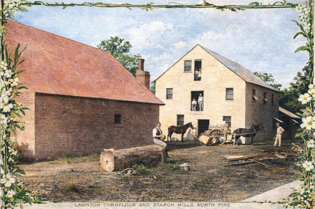
“When the North Coast railway was constructed the government acquired land for a station from Stephen Lawn, and named the station (1888) Lawnton. A post office was opened in 1889. The district had mixed rural occupations: timber cutting, dairying, pig-raising and maize growing. Silt flats along the river grew good maize, and in about 1900 the Paisley corn flour and starch mill began operation in Gympie Road, beside Four Mile Creek. Paisley Park is a reminder of the mill. In 1905 the Acclimatisation Society, having lost much of Bowen Park in Brisbane to the Exhibition and the railways, moved its operations to the south bank of the North Pine River. “
From the Queensland Places website
Lazaret
The location of Peel Island in Moreton Bay made it an ideal site for a quarantine station, and it operated in that capacity to replace Dunwich, which was in use for the Benevolent Asylum. Occasional quarantine emergencies still arrived at Dunwich, much to the consternation of management. Peel Island’s use as a quarantine station was suspended in 1907, and that activity moved to Lytton.
The other side of Peel Island became the Lazaret, where people who had contracted Hansen’s disease, or leprosy, could be housed long-term. The disease was long considered both untreatable and highly contagious, which led to some patients suffering isolation and privation on the island for years.
Leichhardt, Ludwig

Ludwig Leichhardt was a German explorer who disappeared after leaving the Western Darling Downs in April 1848. Leichhardt was lionised in his lifetime, and the mystery of what happened to him endures. Numerous expeditions were launched in search of his party, but all returned disappointed.
Leichhardt is commemorated in in rivers, electorates, streets, waterfalls, schools and towns; as well as flowers, trees, grasshoppers and fish. Some of the specimens Leichhardt collected are kept in herbaria and botanical gardens to this date. Leichhardt Street in Brisbane, is one of the city’s best-known thoroughfares, winding its way through Spring Hill, and blending historical single residences with modern shops and offices.
Lindum
“A station on the Cleveland Railway line (1889), Lindum was situated well away from the urban settlements of the early twentieth century. A post office was opened in 1916. The post office directory of 1949 recorded a mixed business in Sibley Street, a Baptist church in Kianawah Road and a couple of dairy and poultry farmers. In the 1950s each side of Rodney Street still had furrows where pineapples were once farmed.”
Queensland Places website.
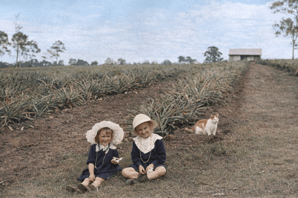
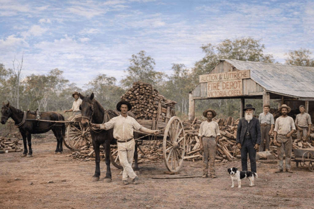
Logan area
It’s a city of its own now, but its history goes back to the Moreton Bay convict era. It was named after Patrick Logan (1791-1830), who commanded the penal settlement from 1826 until his death in October 1830. Logan had charted the river in the area, and the area around the river soon became known as “the Logan.” Over the years, plantations and farms dotted the landscape, and small hamlets became suburbs.
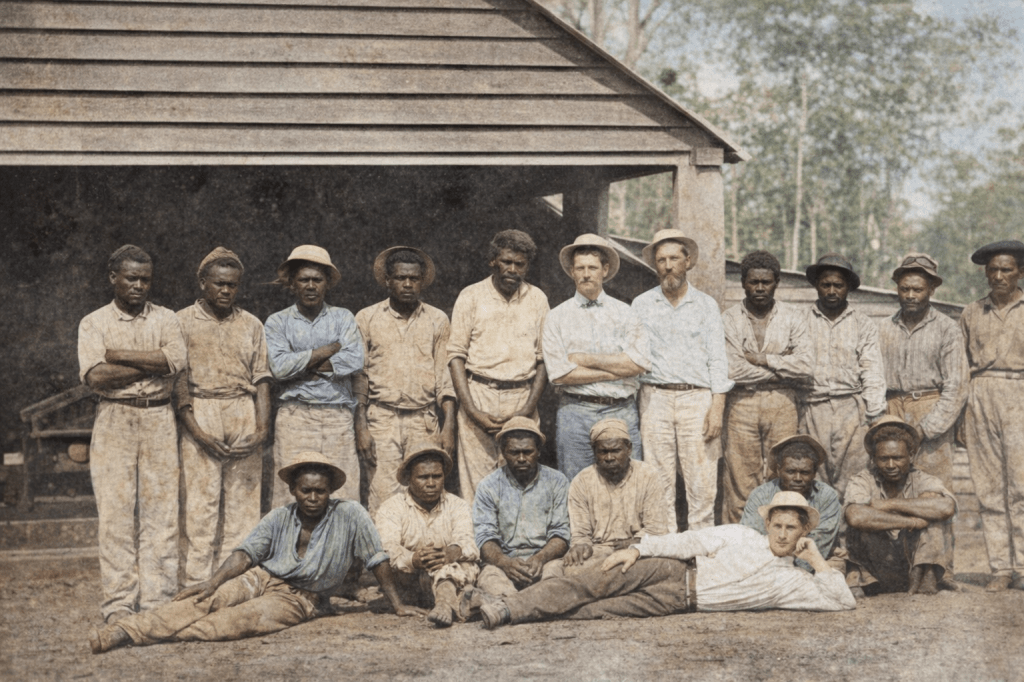
Before the sugar plantation boom in the north, the Logan district had some highly profitable plantations. Owners employed (and I use the term loosely) South Sea Islanders as labourers. Here is a group at Windaroo around 1870, understandably not happy to have been rounded up to work in a strange country with little prospect of proper recompense.
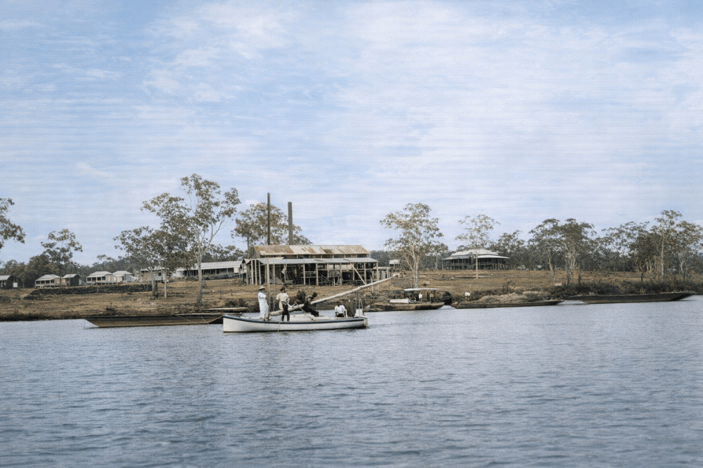
The river that made the area so useful for sugar plantations and milling is seen here in an undated photo of the Gramzow mill.
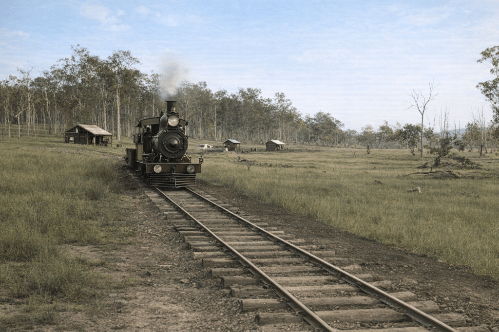
Rail and steam arrived, and here is the Upper Logan terminal on the Beaudesert Tramway in 1902.
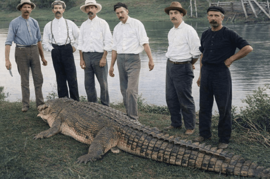
Yikes. 1905 saw this monster caught by this group of game souls in the Logan River at Logan Village. Hopefully, this was an unusual sight even then.
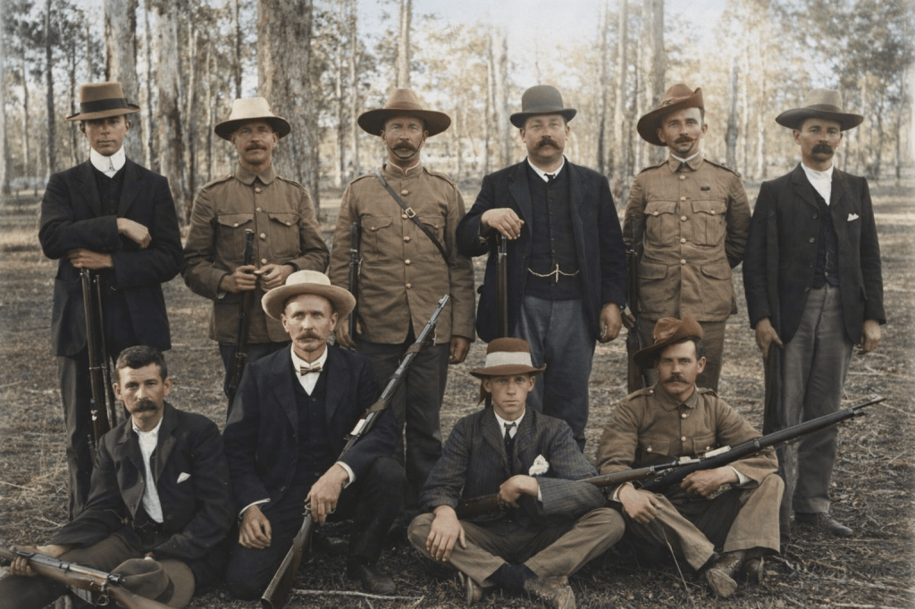
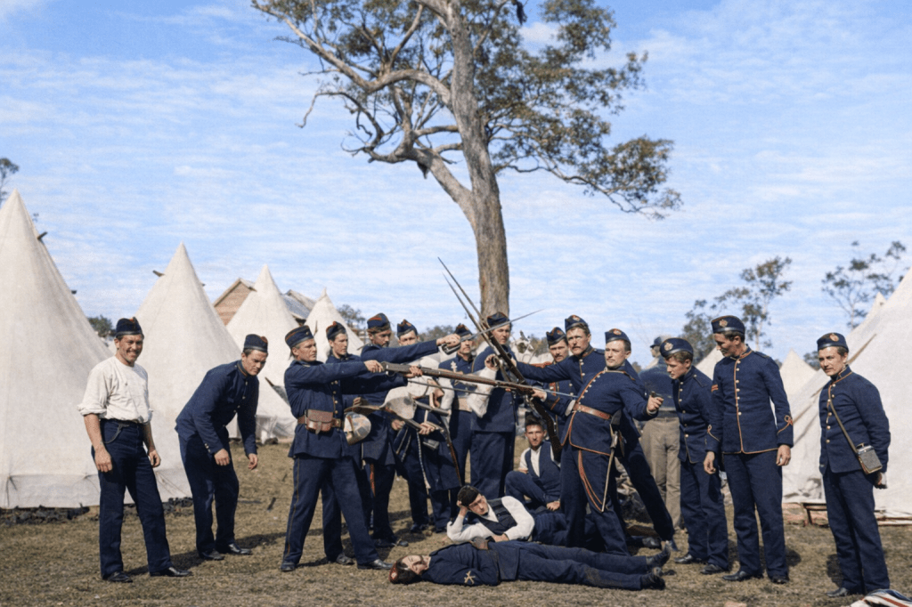
And here are the Logan and Albert riflemen at a meeting in 1909. By the looks of it, some men still had their Boer War kit about the place.
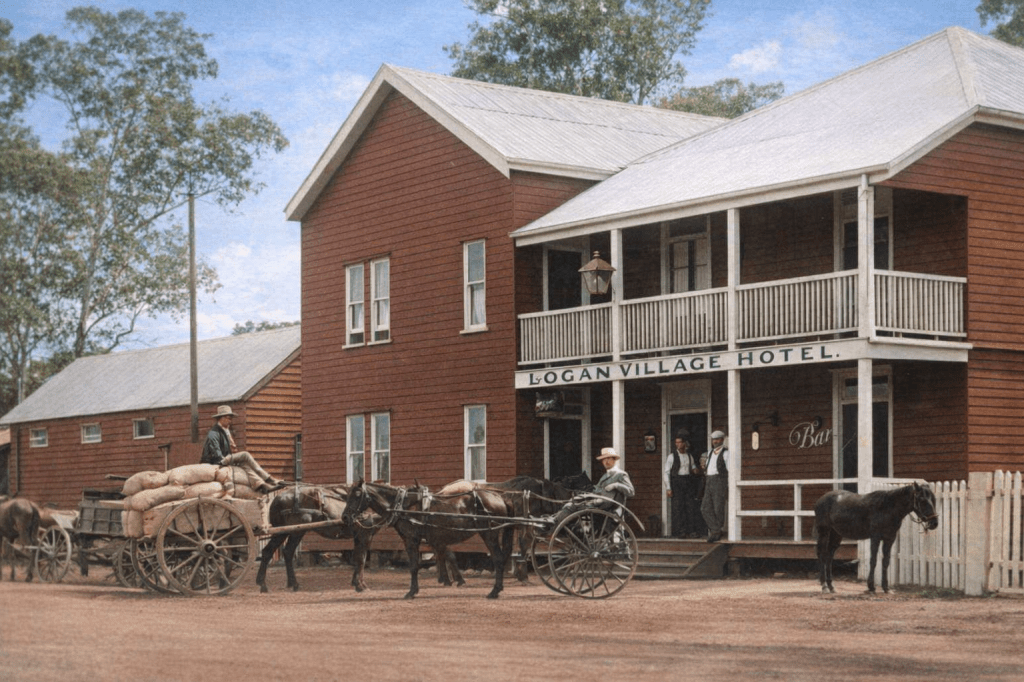
This could have been a scene from any time between European settlement in the 1840s to the era of trucks and cars in the 1920s, but it is 1912.
Lutwyche
Lytton
Lytton has a long association with the military. Its location was seen as a good place for defending Brisbane from threats from French or Russian invaders. In those days, Moreton Bay was a far-flung and probably vulnerable outpost of the British Empire, which viewed the colonial expansion of Germany and France with deep suspicion.
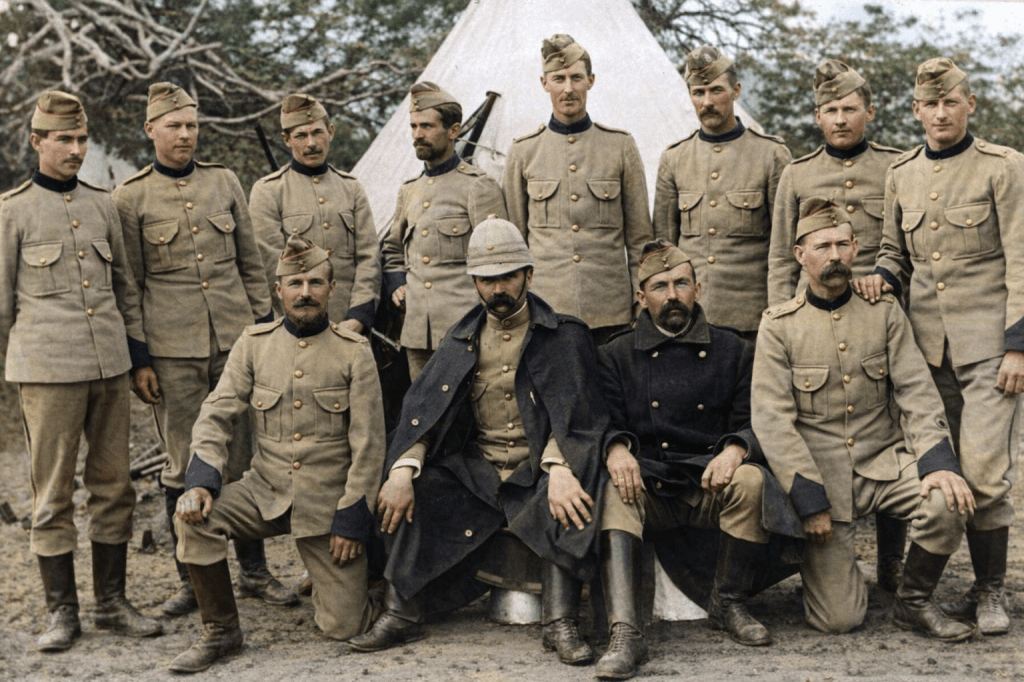
Early use in European times included signal stations, the anchoring of the reformatory hulk Proserpine, and the Reformatory School for boys. Eventually, a proper fort was built, with guns and a minefield, and it served as the main training ground and encampment for soldiers in the Boer War and the First and Second World Wars.